Copyright © 2026 Tauá Turismo. All rights reserved.
Created by By Simplai
Copyright © 2026 Tauá Turismo. All rights reserved.
By Simplai
Many of the Amazon’s secrets have been unveiled, but is it still an unknown land? Anthropologists, ethnologists, ichthyologists, biologists, entomologists, and many other specialists from various countries have explored the region over the past 300 years, and even today, new plant and animal species are being discovered.
Thanks to modern research technologies, we better understand how it functions, along with its strengths and vulnerabilities. We now know about the resource reserves that are highly coveted for global economic needs.
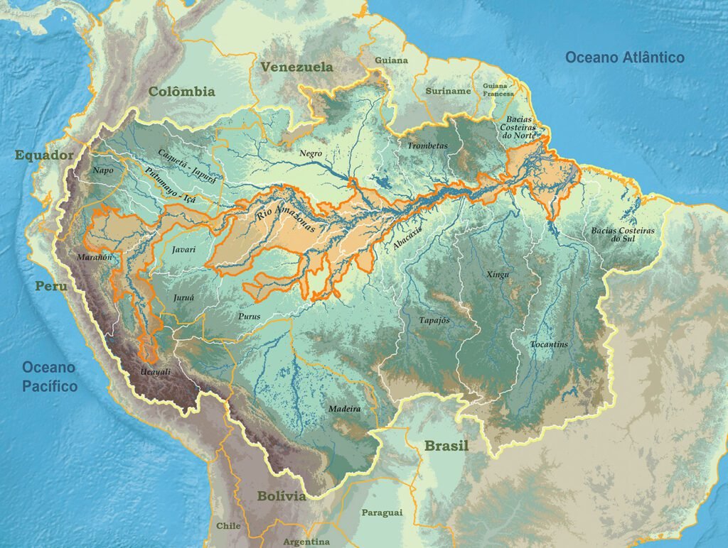
The Amazon is a land of superlatives, covering 6,700,000 km² (12 times the size of France). It is the largest tropical rainforest in the world and the largest freshwater reserve on the planet, with a mythical 6,400 km river that flows across the continent, from the Andes Mountains in Peru (5,600 m above sea level) to the Atlantic Ocean. The Amazon spans 9 countries:
| Brazil (61.8%) | Peru (11.4%) |
| Bolivia (8.4%) | Colombia (6.0%) |
| Venezuela (5.6%) | Guyana (2.5%) |
| Suriname (1.7%) | Ecuador (1.6%) |
| French Guiana (1.0%) |
In Brazil, the Amazon covers 58% (4.2 million km²) of the country’s surface and spans 9 states: Amazonas, Acre, Rondônia, Roraima, Pará, Maranhão, Amapá, Tocantins, and Mato Grosso. The current population of the Brazilian Amazon is 29.6 million, representing 14.5% of the Brazilian population.
According to statistics, 19% of the Amazon rainforest has already disappeared due to Brazil’s economic needs and the global market.
Logging, mineral and oil extraction, and land invasions for sugarcane, palm plantations, cattle farming, and hydroelectric dams are the primary causes of deforestation, unfortunately with a high rate of illegal activities.
It is an enormous territory, making it very difficult to control and develop sustainable economic activities.
The Amazon Basin covers an area of 7 million square kilometers, making it the largest watershed in the world.
It accounts for about one-fifth of the world’s total river flow. The water flowing through the Amazon’s rivers represents 20% of the Earth’s liquid freshwater.
The mighty Amazon River has more than 7,000 tributaries and offers 25,000 kilometers of navigable waterways. It originates in the Andes Mountains in Peru and spans 6,868 km, with 3,165 km within Brazilian territory. Its average flow rate is around 109,000 m³/s, reaching 290,000 m³/s during the rainy season.
The Amazon River got its name during Francisco de Orellana’s expedition, in honor of the Amazons from Greek mythology. According to the account of Brother Gaspar de Carvajal, the expedition’s scribe, they were attacked on June 24, 1542, by a dozen warrior women. These women were fierce, well-armed, tall, white-skinned, naked, and with long black hair.
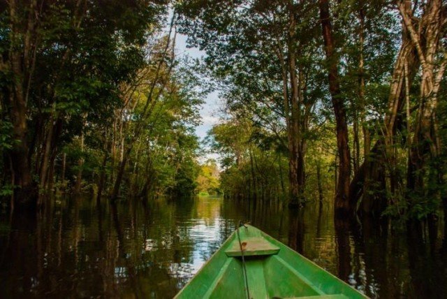
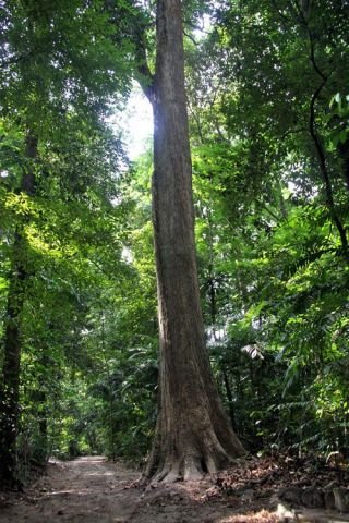
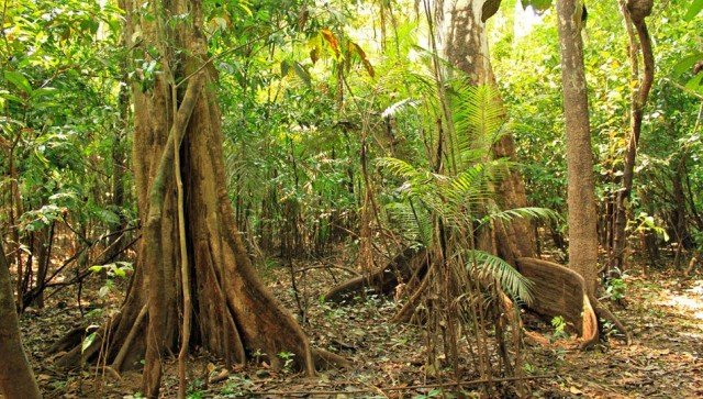
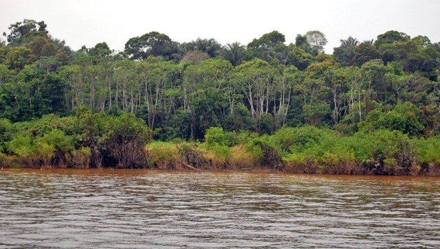
Terra Firme Forests: Higher regions not flooded by rivers, with large trees.
Várzea Forests: Areas that flood during certain periods of the year. In higher areas, the vegetation resembles that of terra firme forests. In flat areas, with prolonged floods, the vegetation is similar to igapó forests.
Igapó Forests:Lower lands that are almost always flooded, with low vegetation such as shrubs, vines, and mosses.
Others: Savannas, mountain refuges, and pioneer formations.
Plant species are divided into trees, herbs, shrubs, climbers, and lianas (vines). Many of these species have significant medicinal potential and have long been used by indigenous populations, drawing interest from the pharmaceutical and cosmetic industries. According to WWF Brazil, approximately 40,000 plant species have been scientifically classified in the Amazon biome.
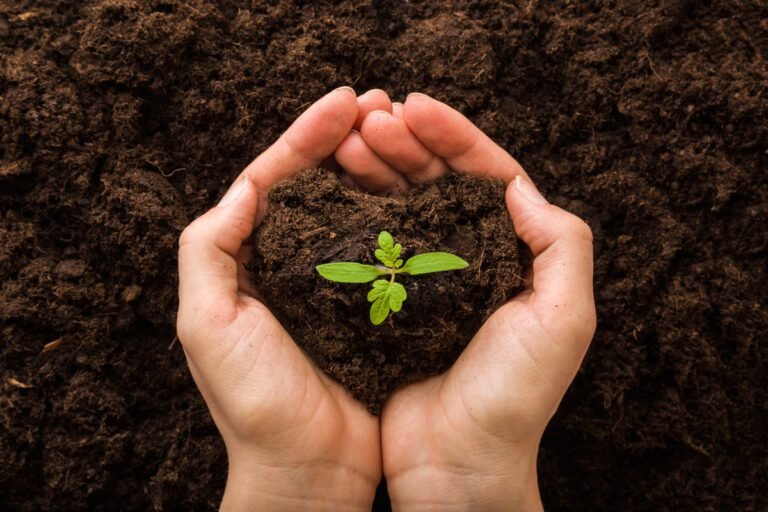
The soil of the Amazon rainforest is generally sandy and has a thin layer of nutrients formed by the decomposition of leaves, fruits, and animals. This humus-rich layer is essential for some plants. In deforested areas, heavy rains wash away the soil, depleting its nutrients and leaving it even poorer. Only 14% of the entire territory is considered fertile for agriculture.
Trees quickly absorb the few nutrients present in the soil and, by recycling them, enrich the soil again, maintaining the ecosystem’s balance.
Scientifically, the Amazon biome has been classified to include approximately:
All these species have millions of square kilometers to live and survive, far from human presence. To see and photograph them, you need patience, hours spent in a canoe, the ability to observe and listen, and a bit of luck. You must understand their habits and habitats during the low and high water seasons. It’s nothing like safaris in African parks.
The Amazon left an indelible mark on world history with the era of white gold rubber (Hevea brasiliensis) between 1870 and 1918. A testament to the peak of this period is the Amazonas Theater in Manaus, inaugurated in 1897, when the city was known as the “Tropical Paris.” This white gold fever created a few millionaires but also turned thousands of rubber tappers, the latex collectors, into prisoners of the forest and their employers.
The workers, brought from the Northeast, suffered from various diseases due to the jungle’s humid climate. However, their precarious working conditions were also due to other serious factors. In the forest, they endured a labor regime that resembled slavery. Payment was made in goods, such as dried meat, cassava flour, molasses, and aguardiente, until the rubber tapper could pay off his debts—something that rarely happened.
There was an agreement among employers not to hire workers with outstanding debts, and rural guards, stationed along the riverbanks, would shoot anyone attempting to escape. Debts accumulated relentlessly. In addition to the original debt for transporting the worker from the Northeast, costs for work tools, such as machetes, knives, and buckets, were added. Since workers needed food and, especially, drink, the longer they stayed in the jungle, the greater their debt grew. Illiterate, the Northeasterners had no way to defend themselves against the accounting tricks practiced by the administrators.
Peasants from Brazil’s Northeast, living in miserable conditions due to frequent droughts, couldn’t resist the recruiters’ enticing promises from rubber extraction companies. Thousands of people voluntarily set off for an unknown region, only to find themselves trapped in a hell of slave labor and conditions even more inhumane than those they had left behind.
The climate is hot and humid year-round.
The minimum-maximum temperature ranges between 23-35°C.
There are two typical seasons:
Summer, from June to November, corresponding to the rivers’ dry season.
Winter, from December to May, during the rivers’ flood season.
The difference between the lowest and highest water levels varies between 10 and 12 meters.
Average rainfall is 2,000 mm per year, with more frequent precipitation during winter. Summer is windier.
The best time to visit is in **September – October**, when you can enjoy both the sandy beaches and the flooded forest (igapó).
However, at any time of the year, discovering the Amazon is a wonderful and unforgettable adventure.
Tauá Turismo: Exclusive ecotourism in the Amazon, navigating the Negro and Solimões rivers. We offer authentic tours for small groups, focusing on nature, culture, and sustainability.
Stay updated on our news and promotions!